-
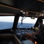
- Bridge setup with Helmsman display ©LIFE BaĦAR for N2K
-
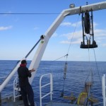
- Sound Velocity Profiler Operation ©LIFE BaĦAR for N2K
The aim of this integral part of the LIFE BaĦAR for N2K project was to map and characterise areas of interest within the 25 nautical mile Fisheries Management Zone surrounding the Maltese Islands to fill data gaps on deep sea bathymetry and seafloor composition, as identified during a prior analysis of existing data. The survey was carried out by the company Geomara, following the award of a tender issued by the Government of Malta’s Department of Contracts on behalf of the Environment & Resources Authority (ERA) (tender CT3105/2015).
The surveys commenced on the 28th of July 2016, and were finalised one month later, on the 28th of August. The first part of the work, the bathymetric survey, was completed on August 17th, and acquired acoustic data to map a total of approximately 130,000 ha of seafloor. The second part – sediment sampling for characterisation of benthic habitats – started on the 20th of August and was finalised on the 28th of August. A total of 50 sediment samples were collected from the areas previously surveyed by the multibeam echosounder. The bathymetric surveys revealed a diverse bathymetric profile, with underwater ridges, mounds, plateaus and canyons, with water depths varying from -186 to -1192 m.
The data collected will now be interpreted in conjunction with all the other data collected through the Remote Operated Vehicle (ROV) surveys, with the final aim of identifying areas to be proposed for protection.